You can find this route on the BikeSquare app with code 4
**Update on 22nd September 2020**
The following text and the linked "hikes" routes are part of the Gallo Nero Bike Day event on last 20th September 2020. Together with the organising body we decided to let the routes be available all year round, hoping that more and more people decide to cycle on our roads. If you want to visit wineries, restaurants and businesses who joined the event, please call in advance because special menus and prices and opening times may vary without notification.
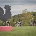
This route stands out for its scenic beauty and easy ride: the road that goes from Radda to the Pietrafitta fork is one of the most spectacular in the entire Chianti territory. For approximately 9 km, this itinerary rises and falls along the ridge, providing views in the distance of Monte Luco, Panzano, Castellina, as well as of the hills that divide the three provinces of Siena, Arezzo and Florence. The route then dips towards Pietrafitta: the descent is challenging and long. Once in Molin Lungo, riders will cross the bridge that divides the territories of Florence and Siena, and then go slightly uphill towards Panzano (1,5 km; elevation difference 3/4% ). At the Volano crossroads, follow directions for Radda – Lucarelli: Radda is about 10 Km away. The first stretch is gently downhill towards the hamlet of Lucarelli, followed by 5 km of flat ride along the Pesa river. The last 4 Km start at the base of Radda and slightly climb until finally entering the town.
Information
-
Departure from Greve in Chianti, Castellina in Chianti, Radda in Chianti
-
28 Km
-
2 hours 48 minutes
- Difficulty: 2


