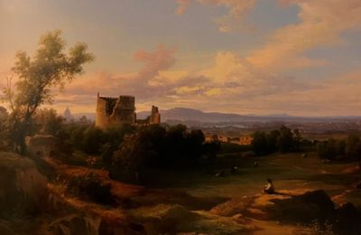
Gran Tour Lazio
- Destination
Roma
Descrizione
Gran Tour del Lazio: Un Viaggio in Bicicletta alla Scoperta della Regione
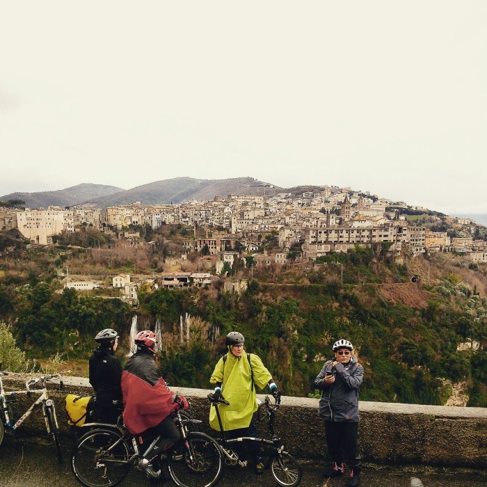
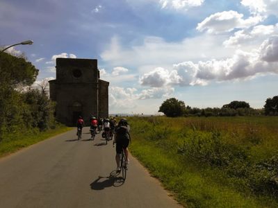
Scopri il Gran Tour del Lazio (GTL), un'avventura ciclistica unica che ti porta attraverso i tesori nascosti della regione. Questo straordinario percorso ad anello di oltre 1000 km parte da Roma e a Roma ritorna, collegando tutte le province del Lazio in 18 tappe perfettamente modulabili.
Il GTL è stato pensato per offrire la massima flessibilità: ogni segmento inizia e termina presso una stazione ferroviaria, permettendoti di vivere l'esperienza secondo i tuoi ritmi. Che tu abbia a disposizione un solo giorno o diverse settimane, il Gran Tour si adatta alle tue esigenze, consentendoti di esplorare il territorio "a moduli" o "a rate".
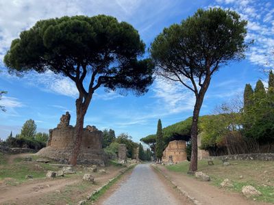
Pedalando lungo il GTL, passerai dalle dune costiere all'Appennino, dai laghi vulcanici alle antiche tagliate etrusche, dai borghi medievali ai rigogliosi vigneti. Il percorso si snoda su strade poco trafficate, cammini di pellegrinaggio e sentieri secondari, lontano dal caos cittadino e immerso nella natura.
Nato come progetto dal basso, il GTL valorizza il ricchissimo patrimonio del Lazio attraverso quattro percorsi tematici: la Ciclovia dei Latini (l'Urbe), la Ciclovia dei Volsci (il Mare), la Ciclovia degli Equi (i Monti) e la Ciclovia degli Etruschi (i Laghi). Un'opportunità unica per riscoprire il territorio con ritmi slow, seguendo le orme del Grand Tour ottocentesco ma con le due ruote.
Unisciti a noi in questa avventura sostenibile che promuove il cicloturismo, rivaluta i borghi dimenticati e crea una rete virtuosa tra comunità locali, tradizioni enogastronomiche e meraviglie storico-artistiche del Lazio.
Itinerary in stages
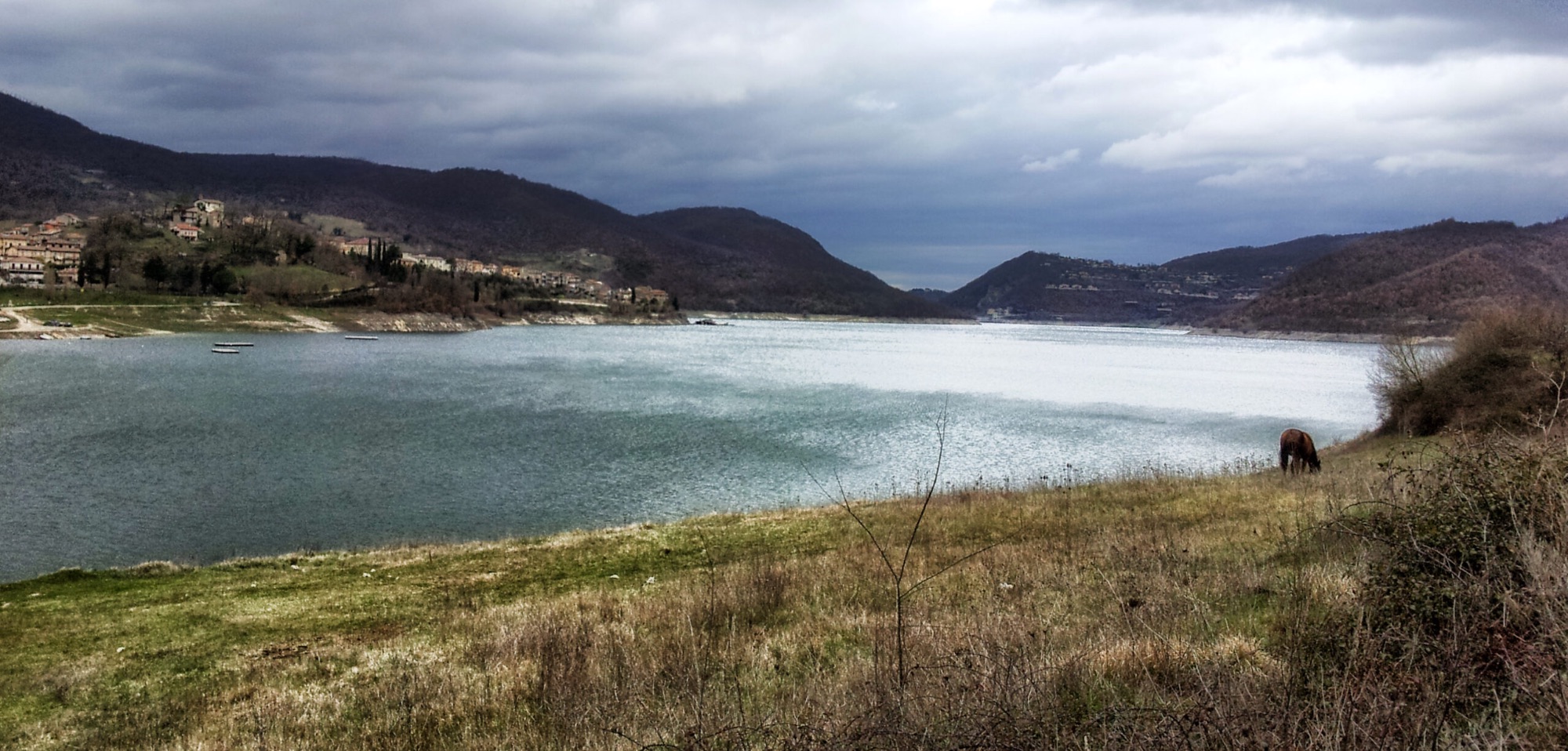
LAKE TURANO
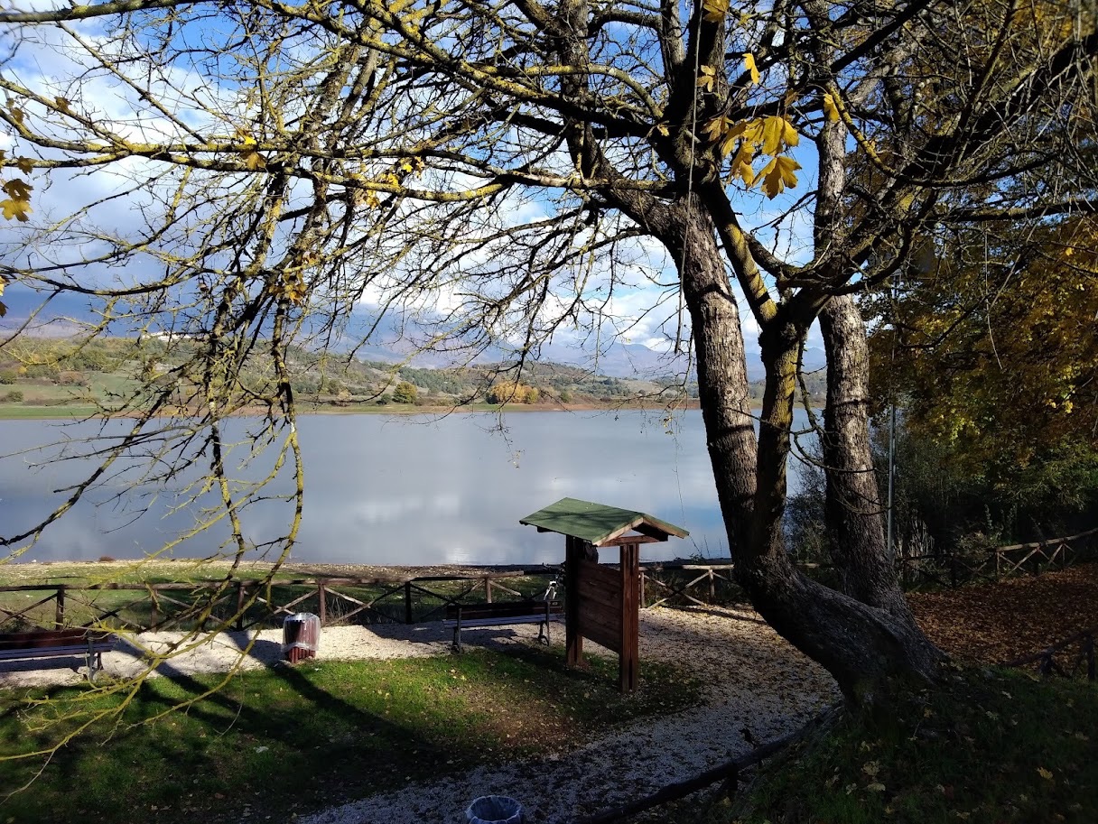
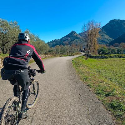
Once on the border with Abruzzo, the GTL route turns north and heads to Sabina, towards the fourth provincial capital of the region: after Rome, Latina and Frosinone, this stage takes us to Rieti, the "geographical center of Italy". To do so, he chooses the gentler and less harsh route through the mountains, continuing to follow the Way of St. Benedict as already happened in stage 6. We climb in altitude passing through villages set in the green of the Apennine woods, Riofreddo, Vallinfreda, Orvinio, and then enter the Turano valley, where the lake of the same name was formed in 1939, following the construction of a huge dam. In fact, the track follows a flat pace and even slightly downhill as a whole, with only two small uphill climbs, offering the pleasure of pedaling through the mountains without pedaling too much. This valley is not served by train or highways, and has remained relatively quiet and safe from the large tourist flows. The river we skirt, also called Turano, gradually swells until it becomes a fjord, the southern branch of the lake: its contours are often foggy, humid and disturbing. We thus arrive at the two villages of Castel di Tora and Colle di Tora, which look at each other from the two shores of the lake, and the ruins of the castle of Antuni, piled up on a small island near the bridge that joins the two sides. After Colle di Tora there are the only slopes to face to get to the Turano dam: a few hairpin bends in the woods, and we are at the gigantic concrete wall that holds back the course of the river. It is worth a small detour to the villages of Rocca Sinibalda, where the impressive Sforza Cesarini Castle stands, originally from the eleventh century, and Posticciola, an original Roman outpost and transhumance passage. From here on it is all downhill: we lose the altitude gained on a road snubbed by traffic, to easily cover the last flat kilometers towards the Sabine capital.
THE UPPER SABINA
The eleventh stage of the GTL changes the landscape once again: we move away from the Apennines for the lower Sabine Mountains, heading west. But the lower altitudes should not deceive, since the slopes of these hills often prove to be more challenging and hard than the mountains proper, with their sudden and violent ups and downs. From Rieti we leave for the beautiful village of Contigliano, on little-frequented and lonely roads among olive trees and vineyards. We are a few steps from Greccio, a medieval town famous for its nativity scenes, certainly worthy of a detour. Hairpin bends, climbs and descents follow one another, giving villages resting on the "hillocks", the heights chosen for settlements since ancient times: Cottanello, Casperia, Cantalupo in Sabina. Only the end of the stage and the arrival in the Tiber valley offers a bit of descent and respite, up to the railway station of Stimigliano, the end of the stage – and a public velodrome, that of Forano.
SORATTE AND SURROUNDINGS
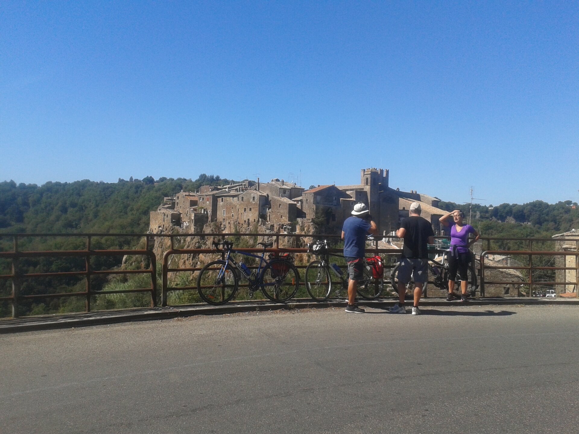
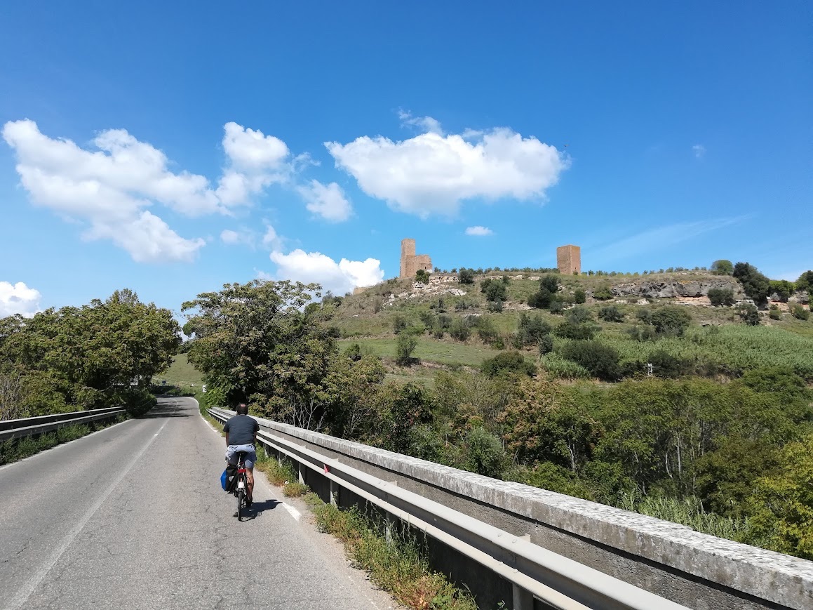
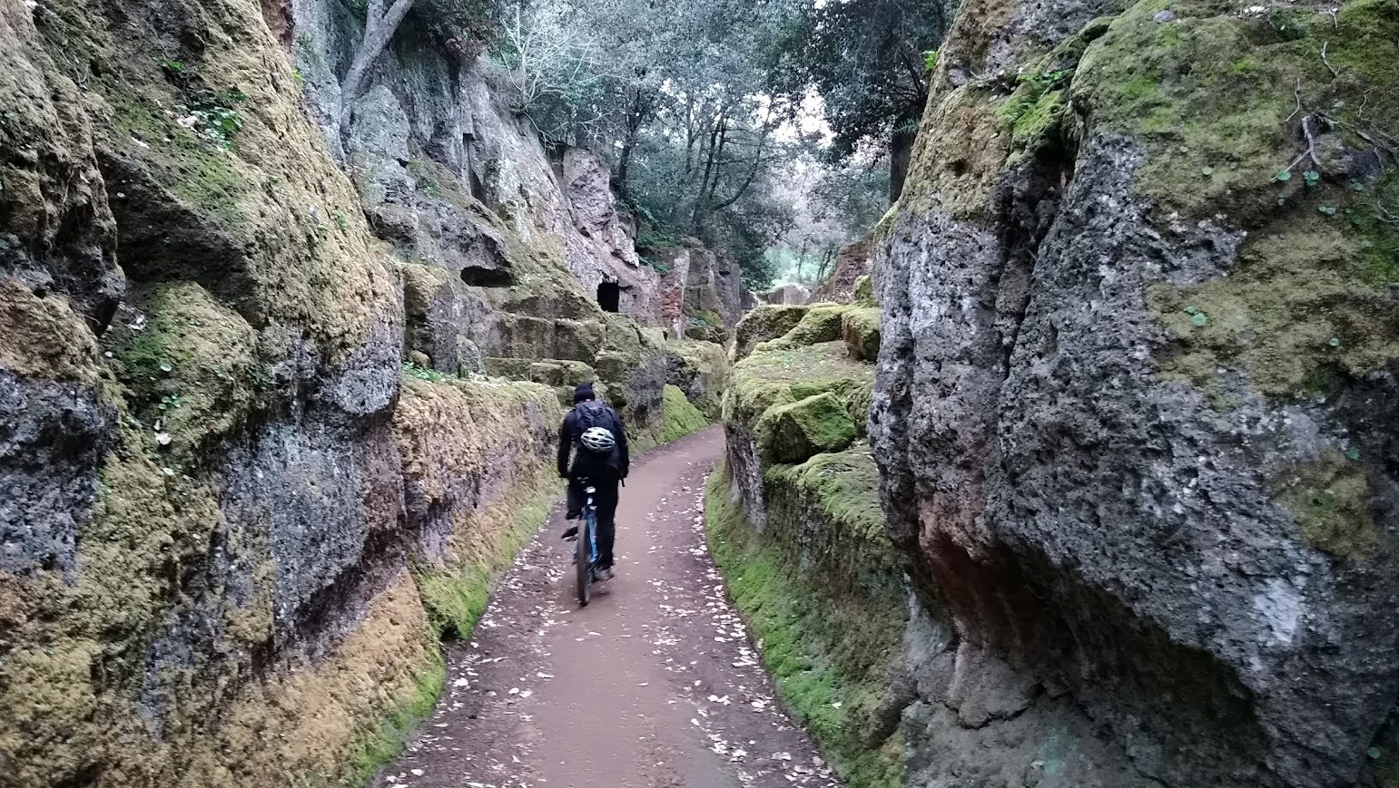
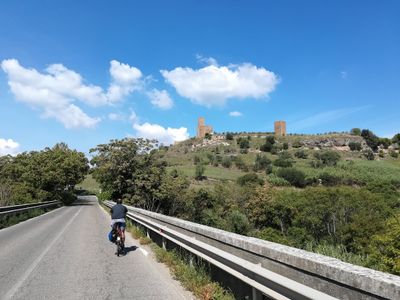
A challenging and fascinating stage, the first in the land of the Etruscans: from here to the end of the GTL, for its entire northern arc, we will cross necropolises, tuff walls and roads cut into the stone and woods, the legacy of a people still partly mysterious and then merged into Roman civilization. From Stimigliano we cross two large "barriers", the Tiber first and then the Autostrada del Sole, to find ourselves in front of the only great giant that stands alone in the Agro Romano: Monte Soratte. With its unmistakable profiles, it is a limestone massif from which numerous hiking and mountain bike trails start, and has always stimulated the imagination of poets, writers and travelers, first of all Horace. To move around these hilly and often winding territories, the GTL 12 uses two European cycle paths, the Eurovelo 5 Romea Francigena and the Eurovelo 7 We continue along winding roads to Sant'Oreste, then Faleria, an ancient settlement of an ancient Lazio population, the Falisci, until we reach one of the pearls of Upper Lazio: Calcata, perched on a block of tuff in the middle of the Treja valley, is a village that seems to isolate itself from the rest of the world, once a refuge for hippie municipalities, today for craft shops. We continue descending into the woods of the Treja river valley, where there are also many paths and bridleways for fascinating detours such as the one to the Monte Gelato Waterfalls, a real locus amoenus used as a set for many films. From here we make a long bend to cross the Treja river to the north (there are no crossing passages except for very bumpy and impervious), and reach the two pretty villages of Nepi, a Borgia stronghold, and Civita Castellana, which gathers around its Fort San Gallo. Still through the countryside and woods, this time on the western bank of the Tiber, the last kilometers of the stage to Orte flow, also perched on a tuffaceous block and certainly worth a visit.
THE PARK OF MONSTERS, THE CALANQUES AND THE VITERBO AREA
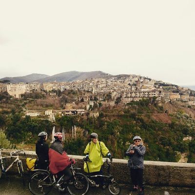
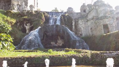
Another not exactly light stage, 1200 meters of total elevation gain for 65 km of distance: the ups and downs of Tuscia relax and engage at the same time, with pristine and green views, narrow streets secluded from heavy traffic, unexpected rock formations and villages set in the landscape. The GTL 13 route uses sections of Eurovelo 5 and Eurovelo 7, as well as Via Francigena. From Orte we cross the Tiber again to cross into Umbria for a short stretch up to Attigliano, and immediately return to one of the most curious attractions of the area, the Park of the Monsters of Bomarzo: in this village lost between valleys and crevasses, in fact, Prince Pier Francesco Orsini had the architect Pirro Ligorio build a garden of "monsters", in the etymological sense of the term wonder, or oddities and fantastic sculptures to distract him from the pain of losing his wife. The route continues in a fluctuating manner through the hills of Tuscia, rows of vineyards and farmhouses, woods and wheat fields, crossing only tiny villages and hamlets such as Santarello or Pallone. Thus we arrive in Bagnaia, a handful of tuff houses close to the Cimini Mountains, made even more fascinating by the sixteenth-century Villa Lante, one of the most beautiful Mannerist gardens in Italy signed by Vignola. From here to Viterbo the few kilometers are all downhill, and you can relax by visiting the wonderful medieval center of the capital, and then conclude the stage between shady roads to Vetralla along stretches of the Via Francigena

VETRALLA / TARQUINIA
The fourteenth track of the GTL is still immersed in the Etruscan lands, and the hills of Tuscia are the masters in this inexorable descent towards the sea. This inexorable descent, however, hides many small ups and downs that make this stage a little more lively, until it reaches an accumulated difference in altitude of about 600 meters. From Vetralla we exit avoiding the busiest roads, to take the provincial road towards Tuscania: the trend is slightly downhill, the panorama that of the typical countryside of central Italy. Farms, rustic villas and rows of trees frame this first stretch of road without any particular crossings, except for a few herds of grazing cows.The somewhat monotonous wait, however, is rewarded halfway along the route, when we enter the beautiful village of Tuscania: with its medieval walls and churches in Romanesque and Gothic style, closed between the Marta and Capecchio rivers, it is leaning against a tuffaceous block like many villages in the area, and while flaunting a timeless dimension it has known various historical eras: from the Etruscan settlements from which it takes its name (Tuscum) to the Roman ones, up to the Middle Ages of the Aldobrandeschi fiefdoms and the era of the Communes.After Tuscania, the trend becomes a bit fluctuating, although it retains a negative difference in height towards sea level: a nice stop along the way is also the Abbey of San Giusto However, we have to reach Tarquinia, which is leaning against gentle hills that partially block the Tyrrhenian wind: to do so we avoid the most direct road, which is a two-lane provincial road, deviating onto secondary roads in the direction of San Giuliano and then falling back before Montalto di Castro. The destination of GTL14 is universally recognized as the capital of the lands of Etruria, one of the largest necropolises and one of the most important Etruscan museums in the world
TARQUINIA / SANTA SEVERA
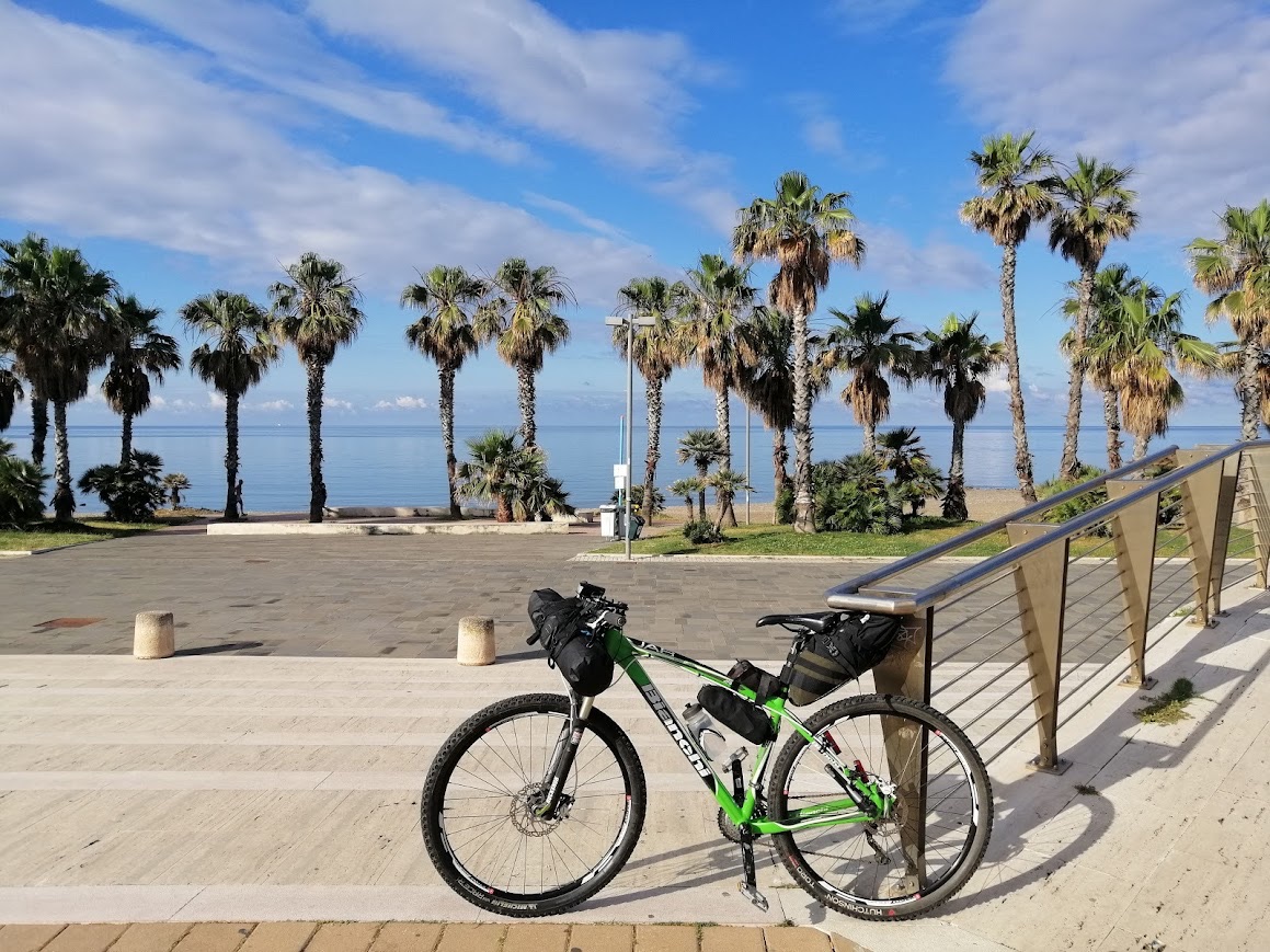
After ten routes inland, between hills and mountains, the GTL15 returns to the sea, this time north of Rome: it is a simple and quiet stage, about fifty km almost all on the plain, sheltered by the coastal chain of the Tolfa Mountains. This stage follows the course of the future Tyrrhenian Cycle Route, of which there are only a few small sections, following the course of the busy Via Aurelia in parallel and taking advantage of its coplanar and secondary roads. From Tarquinia we lose the remaining altitude by gaining the coast, and from there we head south: on our route, pleasant seaside resorts such as Tarquinia Lido and Santa Marinella, as well as important ports such as Civitavecchia. The track winds around the new Aurelia trying to avoid it in every way, now on the seafront of the villages crossed, often already equipped with safe cycle paths, now on the roads of the hinterland. Our destination, Santa Severa, is embellished by the scenic Castle, which stands right on the sea, on what was the ancient site of Pyrgi, an Etruscan settlement.
SANTA SEVERA / BRACCIANO
In its sixteenth stage, the GTL once again leaves the sea to go inland, in the last stretch towards Rome, one of the most scenic: the Tolfa Mountains, the Sabatini Mountains and the area of the volcanic lakes north of Rome. Leaving Santa Severa and its castle, we take secondary roads in the countryside close to the Aurelia through the Macchiatonda Regional Nature Reserve, up to Cerveteri. Here it is certainly worth stopping for a visit to the splendid Etruscan necropolis of Banditaccia. From here we return to the coast to pass the seaside resorts of Ladispoli and Marina di San Nicola, connected to each other by a cycle path obtained from the route of the old railway line, near the imposing Odescalchi Castle. After San Nicola, the maritime landscape gradually gives way to barren hills first, and then to lush pine forests, until it climbs into the woods in the direction of Castel Giuliano, a few steps from the waterfalls of the same name and its ancient fortress. A little more climb near the Caldare di Manziana and its woods, and the vegetation becomes even thicker: we have reached what was the edge of the volcano, and we can look into the blue of its original crater, Lake Bracciano. The destination of this stage welcomes us in a spectacular way, with its tuff houses piled up and gathered around the imposing Odescalchi Castle.
BRACCIANO / ANGUILLARA
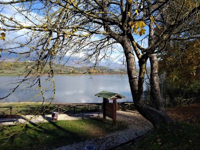
A spectacular stage all around Lake Bracciano, to discover its treasures scattered around the villages that overlook it, almost entirely on roads without traffic, bridleways and dirt paths but easy to follow. From Bracciano we exit northwards following the railway line along dirt roads or dirt roads, in the thick of the woods that hide the panorama of the lake and then make it appear suddenly from time to time: we thus arrive in Manziana, a beautiful village near the centuries-old forest of the same name, and then via a bridleway in the countryside to the Antica Monterano, ghost town that knew various eras, each of which has left a mark of its passage: from the Etruscan tombs to the Roman walls, passing through the papal aqueduct and a couple of sculptures by Bernini and the evocative ruins of the seventeenth-century Church of San Bonaventura, which remained so since the town was abandoned following the Napoleonic invasion. Still passing through dirt roads and dirt roads we arrive in Oriolo Romano, another charming village on the northern side of the lake, and from here we take the cycle path of the woods, which crosses the chestnut groves of Calandrina and then descends to Trevignano Romano, right on the shores of Bracciano. To avoid the busy lakeside promenade up to Anguillara, we use a suggestive detour always traced on dirt roads, the cycle path of the lakes, which cuts the ridge between Lake Bracciano and that – smaller but equally fascinating – of Martignano.
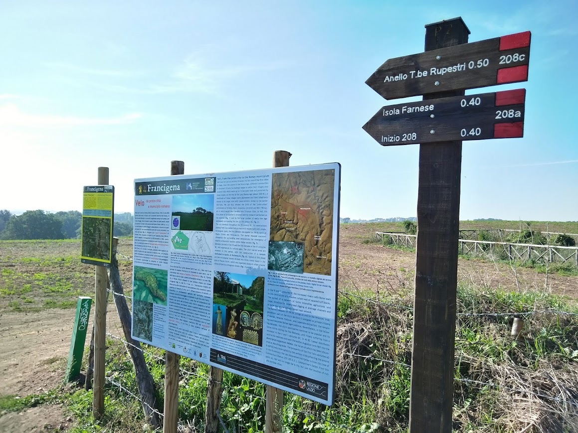
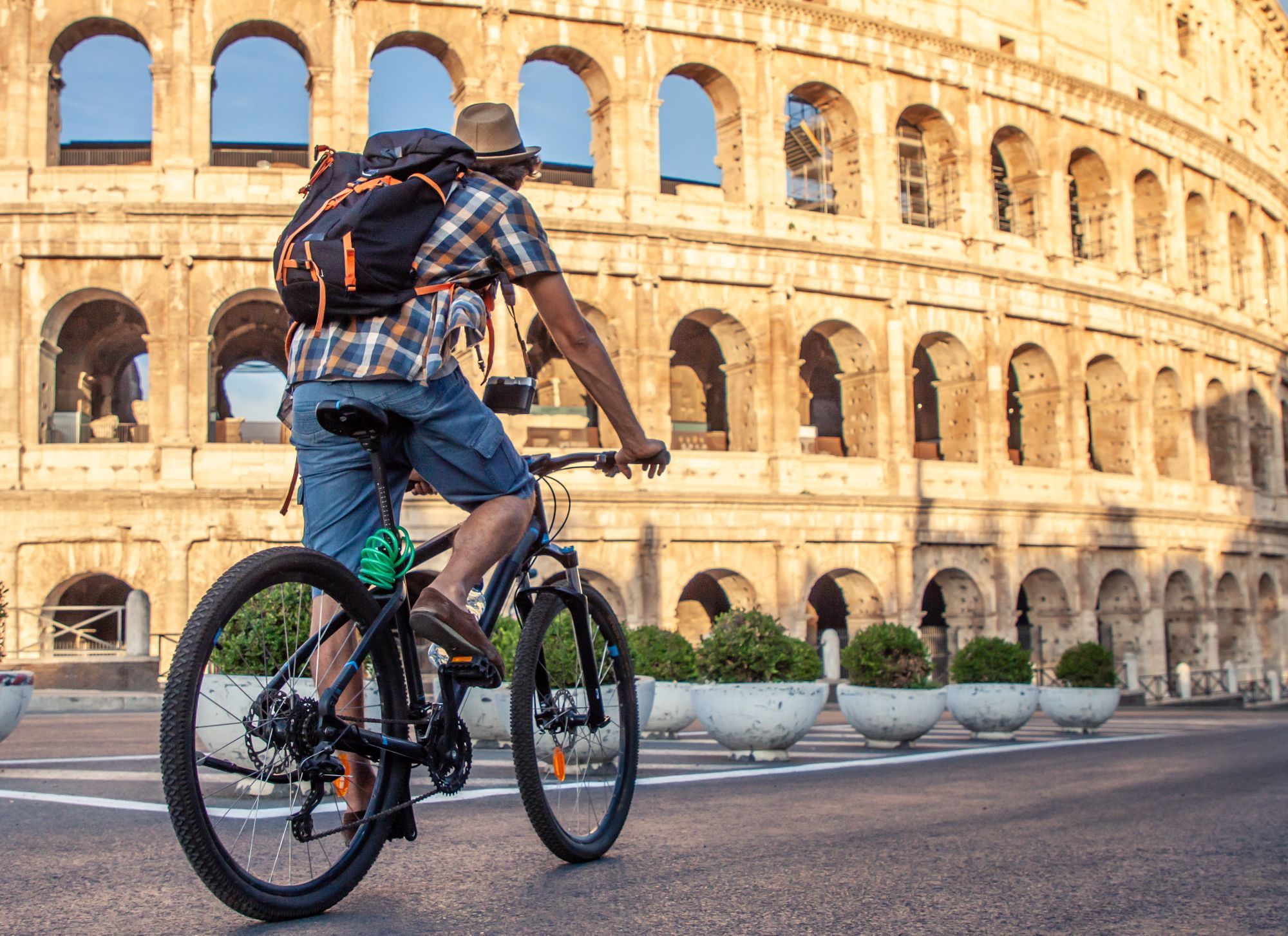
ANGUILLARA / ROME THE VIA FRANCIGENA AND THE VEIO PARK
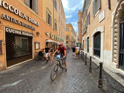
The last stage of the GTL (or the first, if you decide to leave northwards: it is not one-way!) largely exploits the route of the Via Francigena, in the last stretch of the long journey of the pilgrims who arrived in the Holy City. From Anguillara we pass through roads with little traffic near Lake Martignano – depending on the season, it will be more or less pleasant to stop for a swim – and then follow the course of the Cremera stream to the beautiful Sorbo Valley, where the Sanctuary of the Madonna del Sorbo stands. From here we can follow the GPS track and the sporadic indications of the Francigena up to the Veio Park, a city conquered by the Romans in the royal period, whose traces remain in an important archaeological site. We continue our journey towards the city through green patches and streams, along paths that are sometimes bumpy but always fascinating, up to the village of Isola Farnese and the Mola Waterfalls. At this point we still follow the course of the Cremera through secondary roads up to the point where it plunges into the Tiber becoming a tributary: we are now at the gates of the GRA, which we cross with an underpass, and in the northern suburbs of the capital: the entrance to the center is the task of the Tiber ridge, a cycle artery that runs along the river offering unexpected Roman views, from a perspective where traffic does not arrive. The routes to enter Rome include sections of Eurovelo 5 and Eurovelo 7.
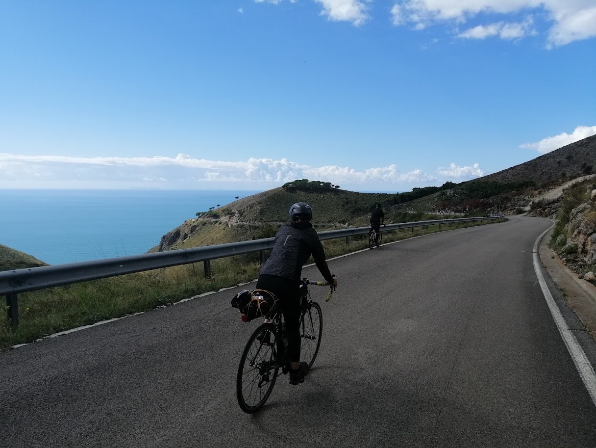
A coastal stop, made up of Homeric suggestions, Greek and Roman history and beautiful villages framed by the overbearing blue of the Tyrrhenian Sea. Spectacular landscapes overlooking the sea, which mark the exit from the papal territories and the entry into what was the Kingdom of the Bourbons: the cultural influence of Naples and the South is felt, after all this is the southernmost stage of the entire GTL, which arrives right at the last municipality before the border of Campania, Minturno. From Monte San Biagio we pass the former customs between the two states, and descend into the plain of Fondi, skirting the lake of the same name. From here to Sperlonga, a charming seaside resort made up of white houses, the step is short. After passing the dirt roads of Lake Fondi, an easy seafront cycle path welcomes us first in the lower part of the village, then in a short climb to the ancient village, in whose alleys it is really worth making a stop. After Sperlonga, near which there are the remains of the villa of Emperor Tiberius, built right next to the sea cave that bears his name, the most spectacular stretch of road awaits us: the Ausoni mountains have been replaced by the Aurunci, and to avoid the Via Flacca, panoramic but full of dangerous tunnels overlooking the sea, we face the climb in the direction of Itri. The climb is challenging and monumental, but the view of the Pontine Islands and the Campanian Archipelago repays all the effort. Before entering Itri, whose castle and olives are still worth a visit, the track makes its way into the folds of the Aurunci until it reaches Gaeta, a fascinating fortified city with a pirate appearance, famous for the Sanctuary of the Split Mountain and for the tiella, the typical rustic cake of the area; the last kilometers towards Minturno run along the port with its murals, crossing Formia and Scauri to the destination.
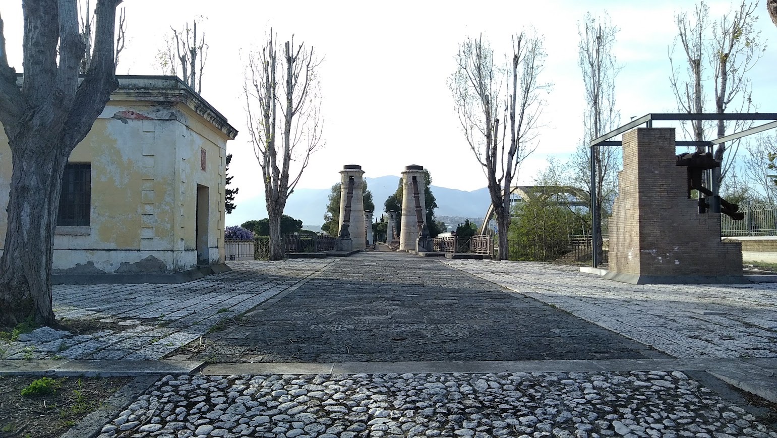
After kilometers and kilometers of coastline, the fifth stage of the GTL heads inland, to retrace the Tyrrhenian stretch of the Gustav Line, the retreat front of the German army at the end of the Second World War. The strategy imposed by Hitler was to leave death and destruction behind, and the villages in this area still bear the signs of what was the scene of bloody war actions between the Nazis and the Allies. We start from the archaeological excavations of what was once a flourishing Roman city of Minturnae, whose aqueduct is still clearly visible from the Appian Way, and we flank the Garigliano river, which at this point is crossed by a beautiful Bourbon bridge, to go up its course along the Way of San Filippo Neri. The road is slightly uphill and the first few kilometers are immersed in the bush, broken only by spas and dams on the river. The track dances on the border between Lazio and Campania, skirting villages such as Castelforte, Santi Cosma e Damiano, Sant'Ambrogio sul Garigliano. The kilometers before Cassino reveal the first signs of the Ciociaria countryside, with the pre-Apennines in front of us and the imposing figure of the Abbey of Montecassino, a Benedictine monastic complex famous for one of the most violent bombings of the last war, where there are still numerous monumental war cemeteries.

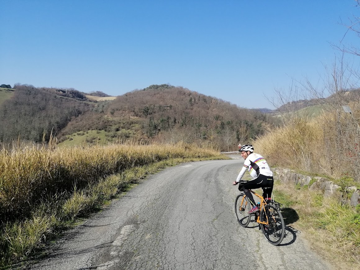
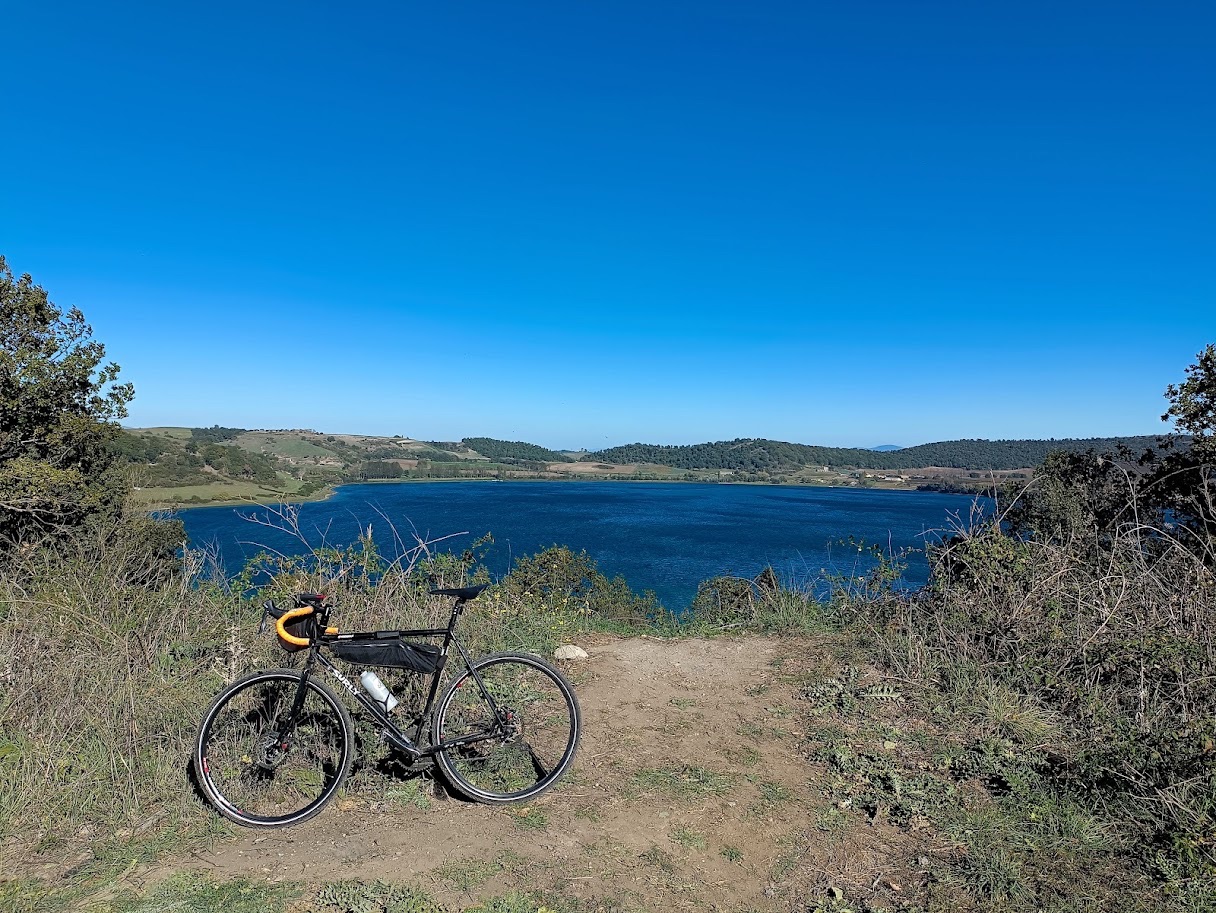
A rather long stage of about 70 km in the Ciocian countryside, between historical traditions and peasant folklore, wonderful medieval villages and sites of naturalistic interest with a wild and unripe charm.Laving Cassino and its imposing Abbey that overlooks it, we flank the course of two major arteries that lead south: the Autostrada del Sole and the Rome/Cassino railway line, which we cross several times along secondary roads. However, we remain on secondary roads and foothills, taking advantage of the already existing route of the Way of St. Benedict at least up to Roccasecca, a medieval town that competes with Aquinas for the birthplace of St. Thomas. We are a stone's throw from the beautiful Melfa Gorges, which certainly deserve a small detour from the GTL route. Continuing, we embrace the route of another great cycle path, the Eurovelo5, or via Romea / Francigena. We are now in the valley of the Ciociarian countryside, squeezed between two pre-Apennine chains: on the left the Lepini Mountains, on the right the Prenestini Mountains. Deviating from the cycle path towards the former, we have the Isoletta-San Giovanni Incarico Natural Park, a river and forest reserve, and the beautiful Pastena Caves. The road continues following the course of the Sacco river between ups and downs and castles, such as those of Roccasecca or Ceccano, until it reaches Frosinone, the third regional capital touched by the GTL.
THE ITINERARY OF THE POPES AND THE OLD ROME FIUGGI RAILWAY
We are on one of the most demanding stages of the entire GTL, 80 km for about 1200 m of elevation gain. However, the route offers the possibility of being further fragmented, since several railway stations are located along the route and you can therefore use the bike transport service by train to shorten the journey.On the other hand, this stage offers a huge historical and cultural heritage, as well as sections of the existing cycle path, the route of the former Rome-Fiuggi railway. Starting from Frosinone, we continue to follow the route of the Eurovelo 5 Romea/Francigena, and we reach the village of Ferentino; from here begins the first of the climbs that characterize the course of the GTL7: the first objective is the village of Fumone, which overlooks the Ernici Mountains, on the top of which stands the imposing Castle owned by the Caetani family, the same as Boniface VIII: here Celestine V was imprisoned and spent his last days, the one who out of cowardice made the great refusal according to Dante; A gloomy and sinister place, it has originated various legends of ghosts over the centuries.From here we continue to the quiet Lake Canterno, until we go up towards Fiuggi, a well-known spa, where we can follow the route of the old railway that until a few decades ago led to Rome: today it is a marked cycle path that passes one after the other the stations of the past, sheltered from the traffic of the Via Prenestina.With a detour it is worth reaching Anagni, another delightful papal village rich in architecture and art.Acuto, Piglio, Serrano, and the route reserved for bicycles is interrupted: avoiding the Prenestina, we continue on Eurovelo 5 which leads us to other wonderful medieval towns such as Gimignano, Genazzano and Cave, ancient papal fiefdoms and a pilgrimage destination for writers such as Gregorovius, and above all Palestrina, whose Temple of Fortuna Primigenia stands out as one of the major pagan sanctuaries of Roman times. From this area there are also many beautiful roads towards the Prenestini Mountains, to deviate from the course of the GTL and challenge the climbs a bit.We hen end the route in Zagarolo, where there is another railway junction for Rome
TOWARDS THE APENNINES: THE IMPERIAL VILLAS, FROM HADRIAN TO NERO.
with the eighth stage, the GTL shifts into lighter gears and pushes into a new environment, never touched before: the mountains. The Lazio region is an Apennine mountain, rough, genuine, which despite not reaching the altitudes of the Alps knows how to offer the cyclist panoramic roads of incredible beauty. From Zagarolo we head north for this stage of approach to the Tiburtini Mountains, only 39 km for a slightly uphill altimetric trend: our destination is in fact Tivoli, but to get there we have to pass a couple of valleys, cross the beautiful villages of Gallicano, Casape and San Gregorio di Sassola, along winding and swinging roads sheltered by the shade of the woods. After crossing the A24 motorway, the last kilometers before Tivoli are gradually ascending through the vineyards. Once we reach our destination, a number of archaeological and tourist sites of world importance leave us spoiled for choice: if the most famous of the attractions remains Hadrian's Villa, the private residence of the Roman emperor of the same name, Villa d'Este and Villa Gregoriana and their fountains offer an incomparable spectacle. The Aniene also passes through Tivoli, which after being born in the Simbruini mountains crosses this city immediately before throwing itself headlong into the scenic waterfalls, and then calming down and flowing into the Tiber in Rome

THE LOWER SABINA AND THE TIBURTINA
The first Apennine stage of the GTL moves towards the border with Abruzzo, near the ancient Via Tiburtina Valeria: to this state road, built on the route of the Roman road commissioned by the consul who extended its course towards the Adriatic from Tibur (today Tivoli), however, the route prefers secondary roads on the other side of the Aniene, sometimes on dirt roads, others on paved roads with little traffic. The Aniene river is the constant of the entire stage: squeezed between the motorway and the state road, in fact, our route winds up and down in the valley carved by this tributary of the Tiber, once sacred to the Romans, in a humid and shady setting.We leave Tivoli by crossing the city gates and climbing imperceptibly towards the mountains: on the right the Lucretili complex and the Monte Catillo Nature Reserve, on the left the Simbruini. From the various villages on the Tiburtina there are countless hiking trails and detours to the peaks.Thus pass the villages and hamlets, built in white stone and increasingly similar to those of Abruzzo: Castel Madama, Vicovaro, Mandela, Pereto, and finally Roviano and Arsoli with their respective castles, a residue of a noble past. But the real tourist attraction of these areas is Nature, with its unspoiled woods and mountains.The difference in height is fluctuating but easy, the vegetation gradually becomes thicker, you gradually gain altitude and the Rome / Avezzano railway line is always there next to you for any problem. From Mandela there is also a route obtained from a former railway that leads to the beautiful Subiaco, certainly worthy of a detour


APP
Travel with the official APP along the itineraries and discover all the points of interest
navigazione-semplice-e-intuitiva-per-esplorare-le-meraviglie-dellitalia-in-e-bike